


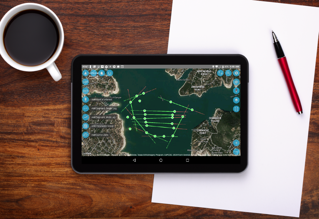
Marine survey proposals are streamlined with the AGI Survey Planner. Plan your survey points, time to completion, and costs—all within the app. Sophisticated surveys can be planned and tested rapidly—even while still in the office.
- Add waypoints, survey segments, parallel line grids, 3D grids, curvilinear survey segments, boundaries, & keep out zones
- Google map integration with offline mode
- Costing based on survey speed, mobilization speed, & time to completion
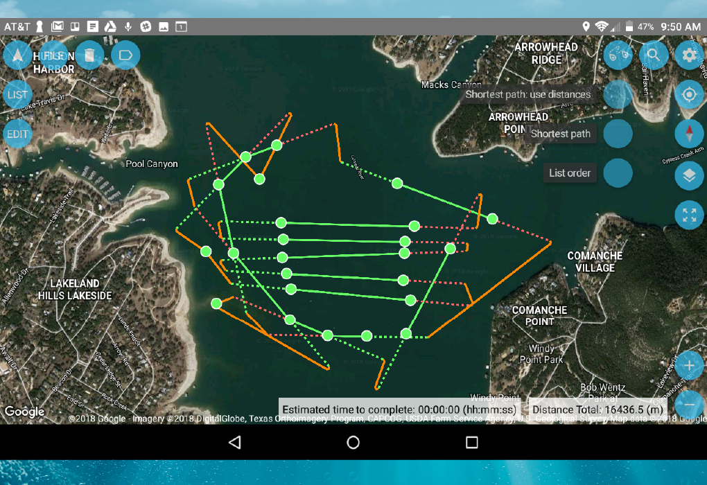
Within seconds, the all-new AGI Route Optimizer Module uses a heuristic algorithm to reduce
This allows you to minimize your travel distance about 30%—which could mean one less day on the water. Save time, save money, collect more data, and easily deal with unexpected route changes.
- Auto-updates a new approach track should you miss your target
- With automatic flexible route optimization, you can reroute to a new target, then reoptimize again to get back on track
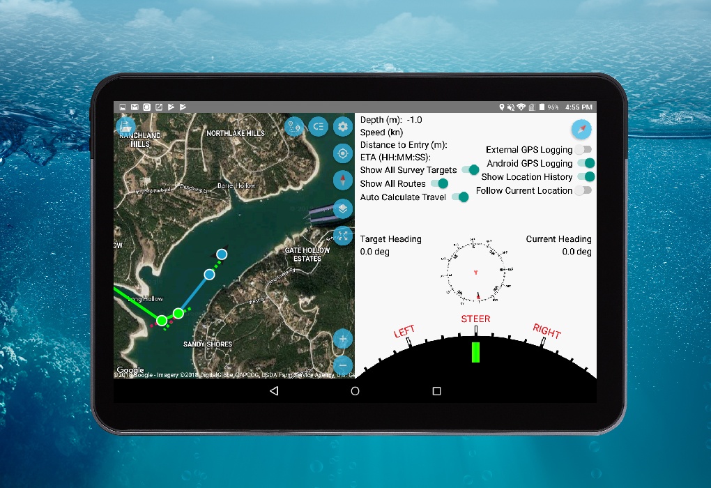
Standard navigation devices aren’t built for marine surveys. The new SuperSting™ Marine System’s App has custom-built Guided Navigation to deal with the positioning variables that come from being on a boat.
- Load tracks directly from the Survey Planner
- A light bar indicates steering directions to follow your planned track
- Projected route indicator that knows where you need to be in order to have a straight cable for the most accurate measurements
- Auto-updates track if you miss your target
- Tuneable to the handling characteristics of your boat when towing a long cable
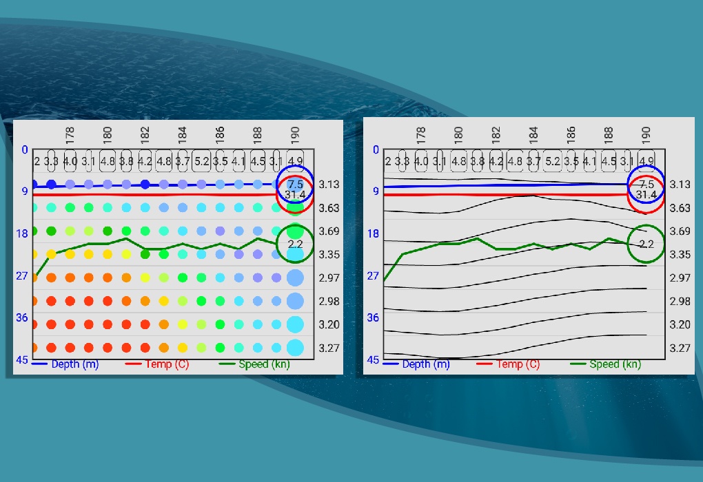
Time is money—which is especially true for marine surveys. Our Marine System allows you to see data plots in real-time, so you can see if any areas need to be revisited. Data is visualized clearly with a dual-screen map so you know exactly where your data is coming from.
- Line plot, colored-dot plot, or both
- See what depth you’re surveying in real-time (a warning indicator flashes red when scanning above the
mudline - Clear and precise visuals
- Understand data density by viewing survey data track on the map
- The visual interface gives you both a size value as well as a visual representation of the resolution at your travel speed

The Earth is a distorted oblate spheroid—so what appears to be a straight line is actually curvilinear. Because of this, our route optimization and map projections apply geodesic corrections for the utmost accuracy.
For professional Geophysical data collection, the standard UTM conformal projection is not precise enough. In small survey areas this may work, but as you travel from one UTM grid zone to another—location error can be several meters.
Our new SuperSting™ Marine System removes this

The Playback Mode is a simple—yet elegant—
Though you can also check the data in real-time, this mode allows you to:
- Review all collected data—as well as where it was collected—before returning to shore
- Visualize and playback your survey to clients and colleagues
- Replay your survey in 1x, 3x, or 5x speed, with all of the functionality of Google Maps
- Even review prior surveys made with older generations of SuperStings™!
Imagine completing your marine survey, getting back to your office, and then reading your data only to see that your GPS was off course the whole time! Our GPS Quality Assurance tool—and our GPS Reader—make sure that this never happens.
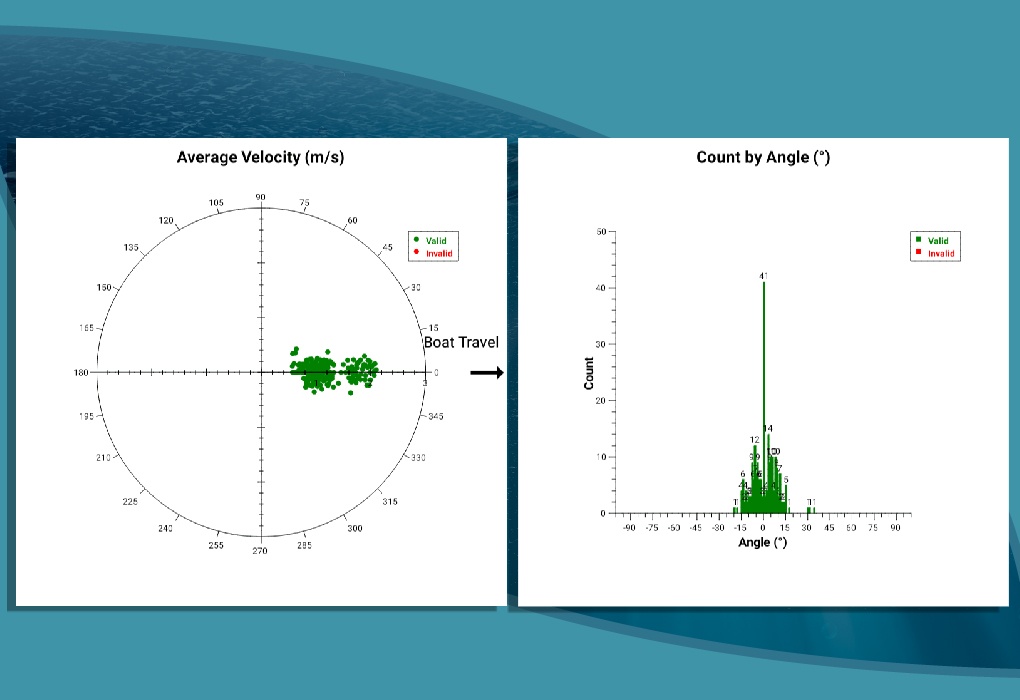
After your survey data is collected, our GPS Quality Assurance Statistics tool will visually show you how well your GPS performed. We take a statistical approach using a sophisticated prediction algorithm and then create a Polar Plot and Histogram Plot for you to review.
- Polar plot view
- Histogram plot view
- GPS data filtering
- You can even collect your tablet’s GPS data as a backup!